というNBER論文が上がっている(ungated版へのリンクがある著者のページ)。原題は「The Topography of Nations」で、著者はTreb Allen(ダートマス大)。
以下はその要旨。
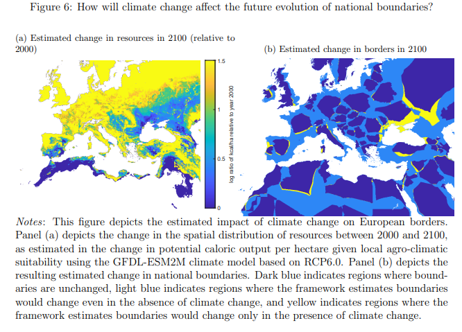
How does the interplay of geography and political-economic forces affect the shape of nations? This paper presents a quantitative framework for characterizing the equilibrium evolution of national boundaries in a world with a rich geography. The framework delivers simple equilibrium conditions based on the efficient transportation of resources that arise from disparate political economic micro-foundations. I characterize the existence, uniqueness, and efficiency of the equilibrium and provide a simple algorithm for its calculation. When combined with detailed spatial geography data from Europe, the equilibrium conditions well approximate observed borders, and the framework is able to successfully predict the evolution of national boundaries and resulting conflict over the past millennia. Finally, I apply the framework to ask how the changing spatial distribution of resources arising from climate change may alter European borders in the future, finding that the Crimean peninsula and surrounding area is especially susceptible.
(拙訳)
地理と政治経済的な力の相互作用は、どのように国家の形状に影響するだろうか? 本稿は、様々な地理を持つ世界における国境の均衡発展を特徴付ける定量的な枠組みを提示する。その枠組みは、政治経済のミクロ的基礎に起因する資源の効率的な輸送に基づく単純な均衡条件を導出する。私は均衡の存在、唯一性、および効率性を特徴付け、その計算の簡単なアルゴリズムを提示する。その均衡条件を欧州の詳細な空間地理データと組み合わせると、観察される国境を良く近似したほか、同枠組みによって過去千年の国境の展開と結果として生じた紛争を上手く予測することができた。また私は、気候変動による資源の空間分布の変化によって欧州の国境が今後どのように変わる可能性があるかという問題にこの枠組みを適用し、クリミア半島とその周辺地域が特に変わる可能性があることを見い出した。
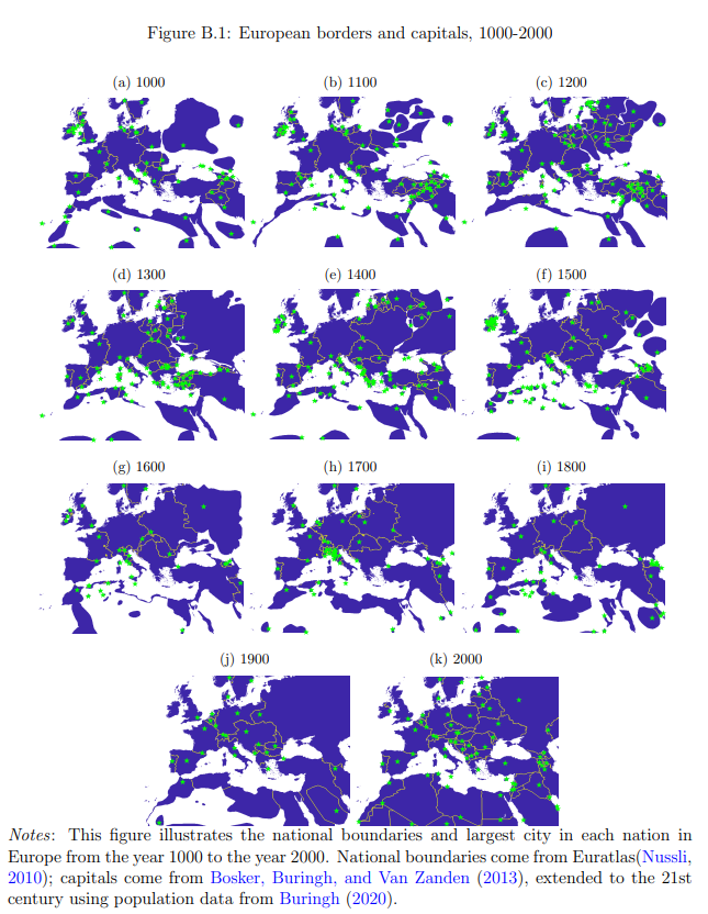
以下は過去1000年の欧州の国境と首都の図。
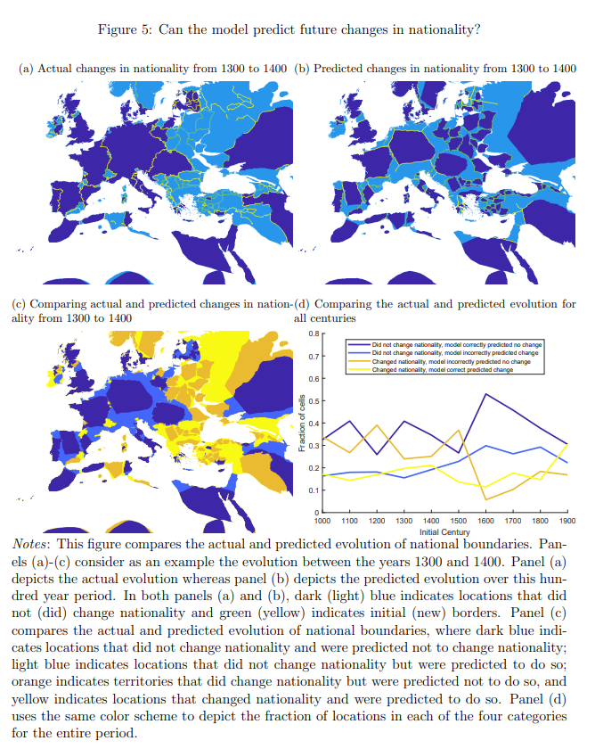
以下は1300-1400年の論文の予測と実際の結果を比較した図。
以下は今後の気候変動による変化の予測図。